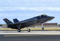
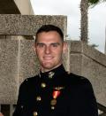
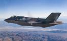
Lockheed Martin test pilot David Nelson, flying F-35B BF-4, took the first synthetic aperture radar, or SAR, maps for an F-35 on 6 January 2011. SAR is a method of ground mapping that uses computer processing to improve radar function. SAR data yields high-resolution, photo-quality images that function as the heart of the F-35 navigation capability.